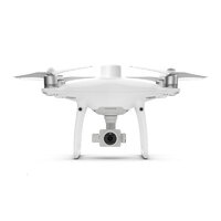
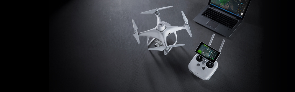
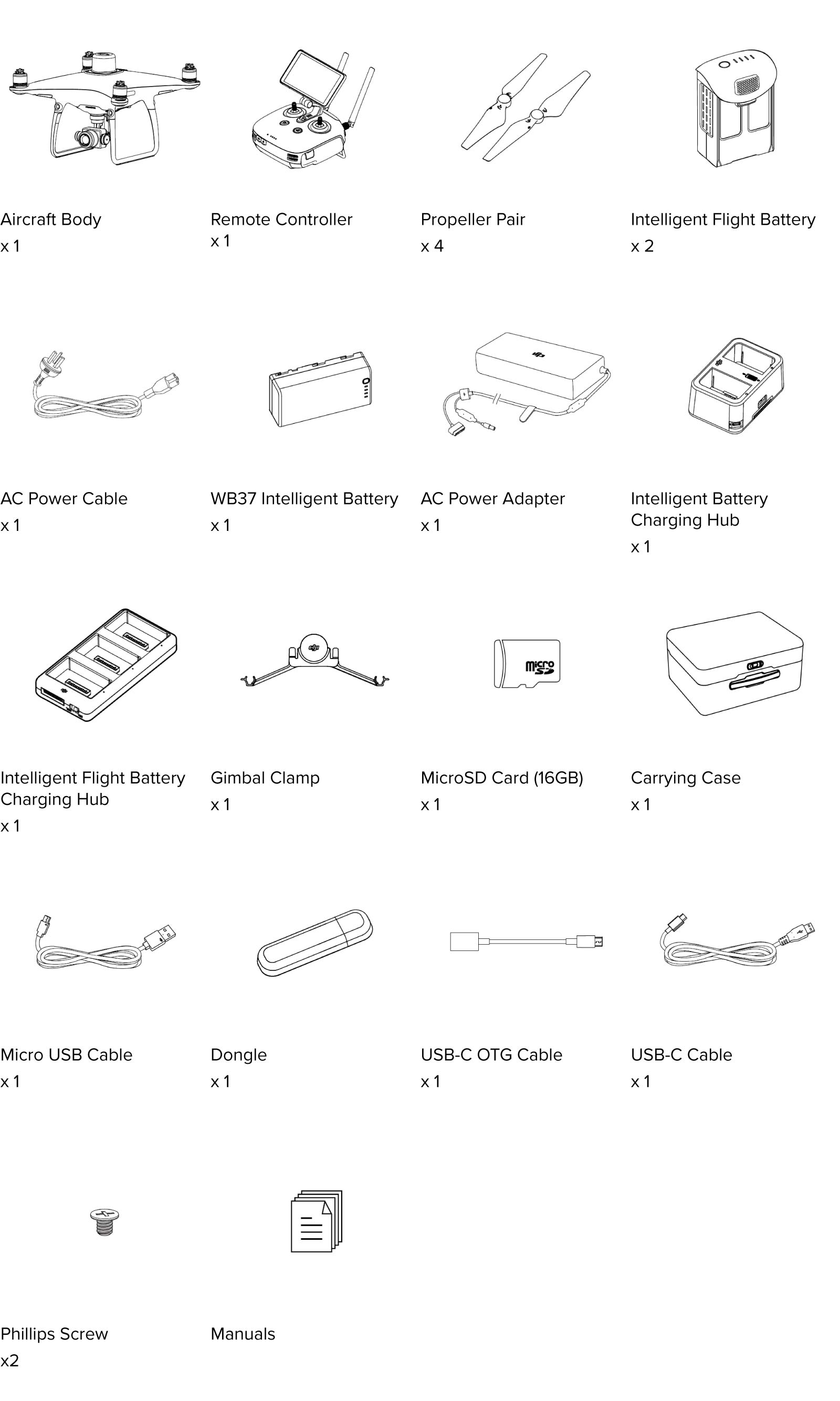
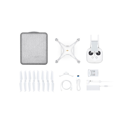
Phantom 4 RTK Combo


Calculate Shipping
Express Shipping - $25.00
Fastest method
Standard Shipping - $15.00 (ETA: 5 days)
(flat rate per order)
DJI has revolutionized aerial mapping with the Phantom 4 RTK. This aircraft gives you centimeter accurate data as well as easy and intuitive software. This is perfect for beginner to professional mappers! The aircraft is also under 2kgs.
Phantom 4 RTK
Visionary Intelligence. Elevated Accuracy.
Upgrade your next mapping mission with the Phantom 4 RTK – the most compact and accurate low altitude mapping solution.
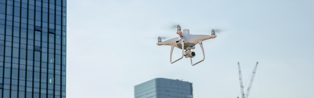

Next Generation Mapping
DJI has rethought its drone technology from the ground-up, revolutionizing its systems to achieve a new standard
for drone accuracy – offering Phantom 4 RTK customers centimeter-accurate data while requiring fewer ground control points.
|
|
|
|
|---|---|---|
|
1cm+1ppm RTK Horizontal Positioning Accuracy |
1.5cm+1ppm RTK Vertical Positioning Accuracy |
5cm* (*When flying at 100m height, 2.7cm GSD, sunny.) Absolute Horizontal Accuracy of Photogrammetric Models |


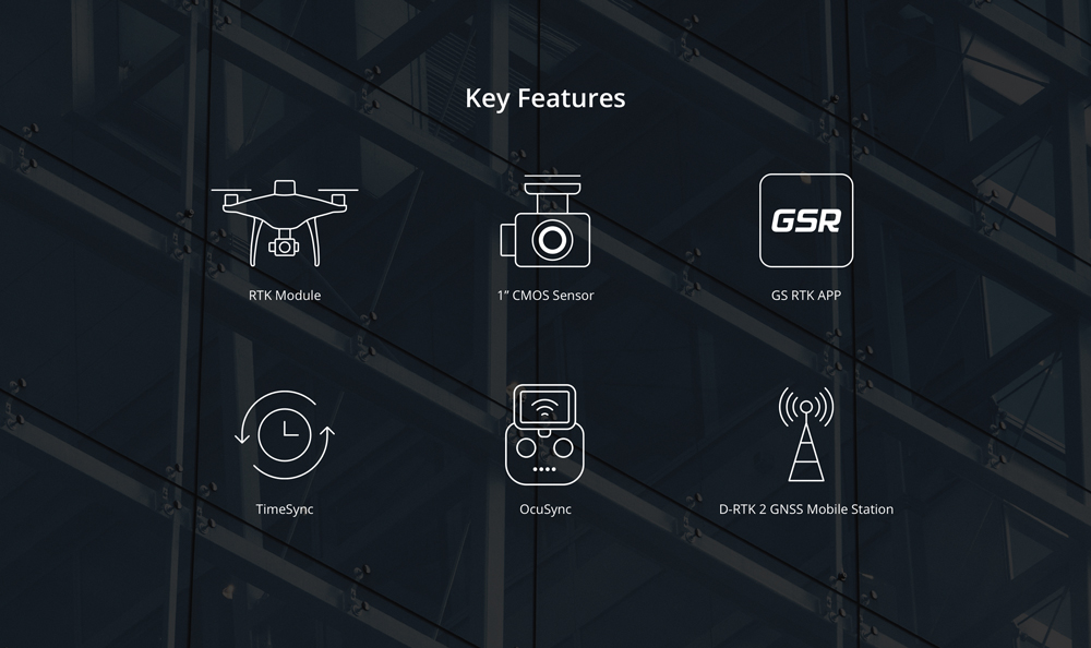
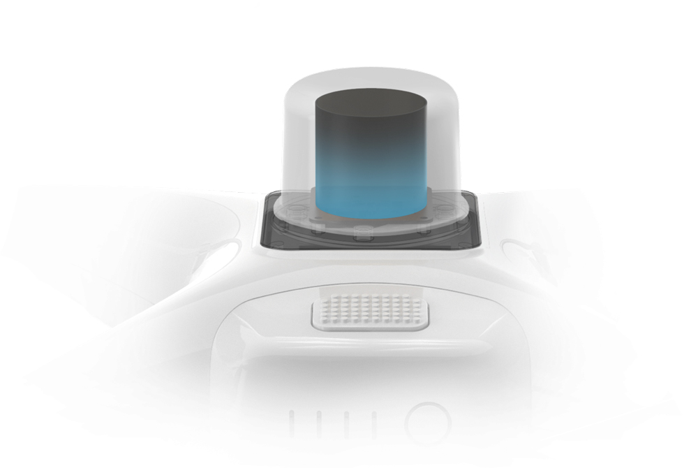
Centimeter level positioning system
A new RTK module is integrated directly into the Phantom 4 RTK, providing real-time, centimeter-level positioning data for improved
absolute accuracy on image metadata. Sitting just beneath the RTK receiver is a redundant GNSS module, installed to maintain
flight stability in signal-poor regions such as dense cities. Combining both modules, the Phantom 4 RTK is able to optimize flight safety
while ensuring the most precise data is captured for complex surveying, mapping and inspection workflows.
Fit the Phantom 4 RTK to any workflow, with the ability to connect this positioning system to the D-RTK 2 Mobile Station, NTRIP
(Network Transport of RTCM via Internet Protocol) using a 4G dongle or WiFi hotspot, or store the satellite observation data to be
used for Post Processed Kinematics (PPK).
Gather Accurate Data with TimeSync
To take full advantage of the Phantom 4 RTK’s positioning modules, the new TimeSync system was created to continually align the flight
controller, camera and RTK module.
Additionally, TimeSync ensures each photo uses the most accurate metadata and fixes the positioning data to the center of the
CMOS – optimizing the results from photogrammetric methods and letting the image achieve centimeter-level positioning data.
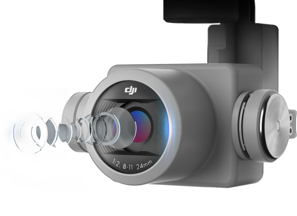
Precise Imaging System
Capture the best image data with a 1-inch, 20 megapixel CMOS sensor. Mechanical shutter makes mapping missions or regular data capture seamless as the Phantom 4 RTK can move while taking pictures without the risk of rolling shutter blur. Due to the high resolution, the Phantom 4 RTK can achieve a Ground Sample Distance (GSD) of 2.74 cm at 100 meters flight altitude.
To ensure each Phantom 4 RTK offers unparalleled accuracy, every single camera lens goes through a rigorous calibration process where radial and tangential lens distortions are measured. The distortion parameters gathered are saved into each image’s metadata, letting post-processing software adjust uniquely for every user.
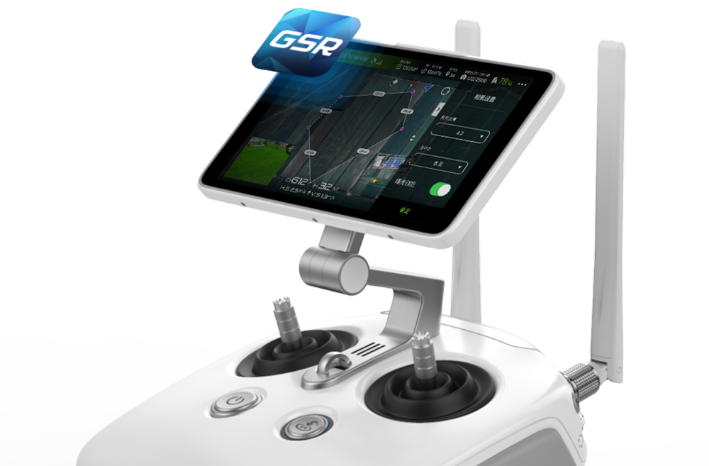
Purpose-Built Flight Planning Application
A new GS RTK app allows pilots to intelligently control their Phantom 4 RTK, with two planning modes – Photogrammetry and Waypoint Flight – alongside a more traditional flight mode. The planning modes let pilots select the drone’s flight path while adjusting overlap rate, altitude, speed, camera parameters and more, offering an automated mapping or inspection workflow.
The GS RTK app has been built with its users in mind and therefore has a range of features built for specific mapping or inspection workflows. The app has implemented direct loading of KML/KMZ files for in-office flight planning, a new shutter priority mode to keep exposure consistent across all photos and a strong wind alarm to warn pilots of adverse conditions.
Mobile SDK Supported
The Phantom 4 RTK is compatible with the DJI Mobile SDK, opening up its functions to automation and customization through a mobile device.
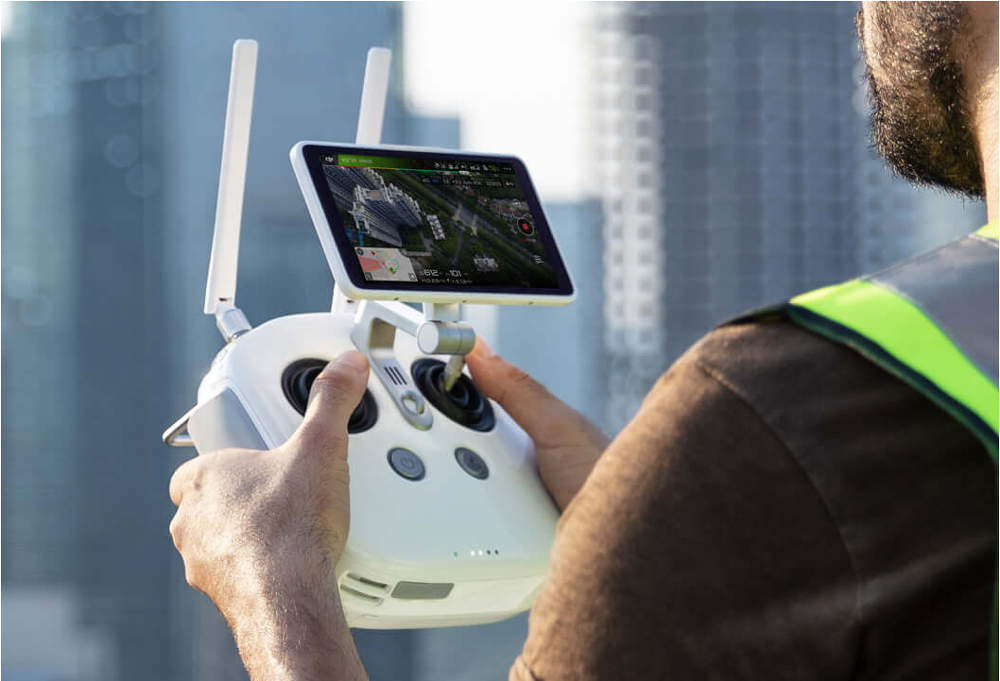
OcuSync Transmission System
Enjoy stable and reliable HD image and video transmission at distances of up to 7 km, great for mapping larger sites.
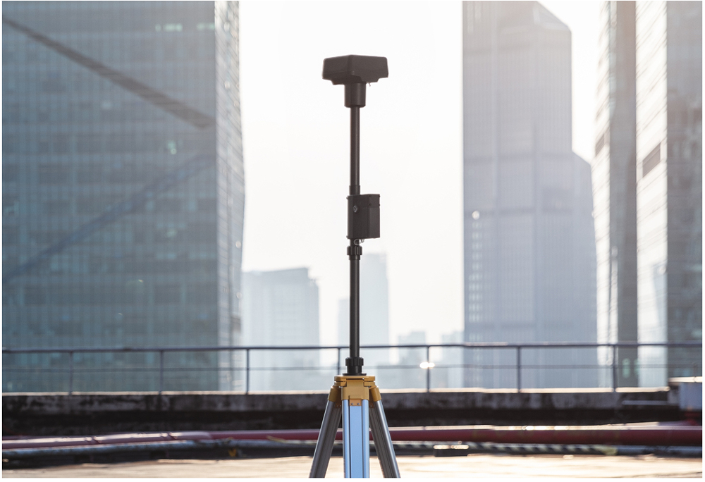
Seamless Compatibility with D-RTK 2 Mobile Station
Support your Phantom 4 RTK missions with the D-RTK 2 Mobile Station – providing real-time differential data to the drone and forming an accurate surveying solution. The Mobile Station’s rugged design and OcuSync transmission system ensures you can gain centimeter-level accurate data with your Phantom 4 RTK in any condition.
Start Mapping Today
With a built-in flight planning app (GS RTK) and an easy method to collect RTK data (RTK Network or D-RTK 2 Mobile Station), pilots have a full solution for any surveying, mapping or inspection workflow – right out of the box.
(18383)
| SKU | 18383 |
| Brand | DJI |
Be The First To Review This Product!
Help other UAV ME users shop smarter by writing reviews for products you have purchased.
